
The Snæfellsnes Peninsula by car
Last updated: 10 November 2026
Prepared by Ring Road Cars at Keflavík Airport and checked against the official sources listed at the end of this page.
Short answer
From Reykjavík, take Route 1 north through the Hvalfjörður tunnel (no toll) to Borgarnes (74 km), then Route 54 west onto the peninsula; from Keflavík Airport, Borgarnes is 117 km. The classic loop follows the south coast past Búðir to Arnarstapi and Hellnar, circles Snæfellsjökull on Route 574 past Djúpalónssandur to Hellissandur and Ólafsvík, then runs along the north coast to Kirkjufell at Grundarfjörður and Stykkishólmur. It is about 480 km from Reykjavík and back (about 570 km from Keflavík Airport), paved all the way, with at least 5 h 20 min of driving, so a day trip makes a long day: plan two days, especially in winter. Check umferdin.is and vedur.is before you set off.
Getting there from Reykjavík or Keflavík Airport
Snæfellsnes reaches about 90 km out into the Atlantic north of Reykjavík, with the glacier Snæfellsjökull at its tip; Visit Iceland calls it Iceland in miniature. The way there:
- From Keflavík Airport: take Reykjanesbraut (Route 41) toward Reykjavík, then Route 1 north from the edge of the city.
- Route 1 to Borgarnes: through the Hvalfjörður tunnel (Hvalfjarðargöng), which has no toll, and over the bridge into Borgarnes: 74 km from Reykjavík and 117 km from Keflavík Airport.
- Route 54 onto the peninsula: just past Borgarnes, Route 54 (Snæfellsnesvegur) turns west along the south side of the peninsula. Two paved roads cross to the north coast: Vatnaleið (Route 56) and Route 54 itself, over the Fróðárheiði heath.
Official road distances from Vegagerðin, the Icelandic Road and Coastal Administration, all on paved roads:
- Stykkishólmur: 172 km from Reykjavík, 215 km from Keflavík Airport
- Grundarfjörður (Kirkjufell): 177 km from Reykjavík, 220 km from Keflavík Airport
- Arnarstapi: 192 km from Reykjavík, 236 km from Keflavík Airport
Visit Iceland puts Snæfellsnes about two hours' drive from Reykjavík, Stykkishólmur about 2 hours 15 minutes and Kirkjufell 2 to 2.5 hours. Distances from Keflavík Airport start at the terminal; you collect your car at our office at Bogatröð 1 in Reykjanesbær, about 10 minutes away by our airport shuttle. Delivery to Reykjavík is possible on request only, agreed in advance and priced individually.
The loop, stop by stop
This is the classic loop, with the south coast first. The distances are Vegagerðin's (distance tables, in Icelandic), which show every leg as paved.
| Leg | Main roads | Distance |
|---|---|---|
| Keflavík Airport → Arnarstapi | 41, 1, 54, 574 | 236 km |
| Reykjavík → Arnarstapi | 1, 54, 574 | 192 km |
| Arnarstapi → Hellnar | 574 | 5 km |
| Hellnar → Djúpalónssandur | 574, 572 | 16 km |
| Djúpalónssandur → Hellissandur | 572, 574 | 25 km |
| Hellissandur → Ólafsvík | 574 | 9 km |
| Ólafsvík → Grundarfjörður | 574, 54 | 26 km |
| Grundarfjörður → Stykkishólmur | 54, 58 | 39 km |
| Stykkishólmur → Reykjavík | 58, 54, 56, 1 | 172 km |
| Stykkishólmur → Keflavík Airport | 58, 54, 56, 1, 41 | 215 km |
Added up, the loop is 484 km from Reykjavík and back and 571 km from Keflavík Airport and back. On the way:
- Búðir: Route 574 (Útnesvegur) begins at Búðir on the south coast, where the black wooden church Búðakirkja stands on the edge of the Búðahraun lava field.
- Arnarstapi and Hellnar: two old fishing villages under the glacier, 5 km apart by road and linked by a 2.5 km coastal path past the stone arch Gatklettur. A large stone monument to Bárður Snæfellsás, the guardian spirit of the area, stands at Arnarstapi.
- Snæfellsjökull National Park: beyond Hellnar, Route 574 runs through the park, which Visit Iceland calls the only national park in Iceland that reaches from a glacier summit down to the sea. Stop at the Vatnshellir lava cave (visited on guided tours), the visitor center at Malarrif and the basalt pinnacles of Lóndrangar. Entry to the park and the visitor center is free.
- Djúpalónssandur: a black pebble beach at the end of road 572, with the lifting stones fishermen once tested their strength on and the rusted remains of the Epine shipwreck.
- Hellissandur, Rif and Ólafsvík: fishing villages on the north coast. Hellissandur has a maritime museum, and whale-watching tours leave from Ólafsvík and Grundarfjörður.
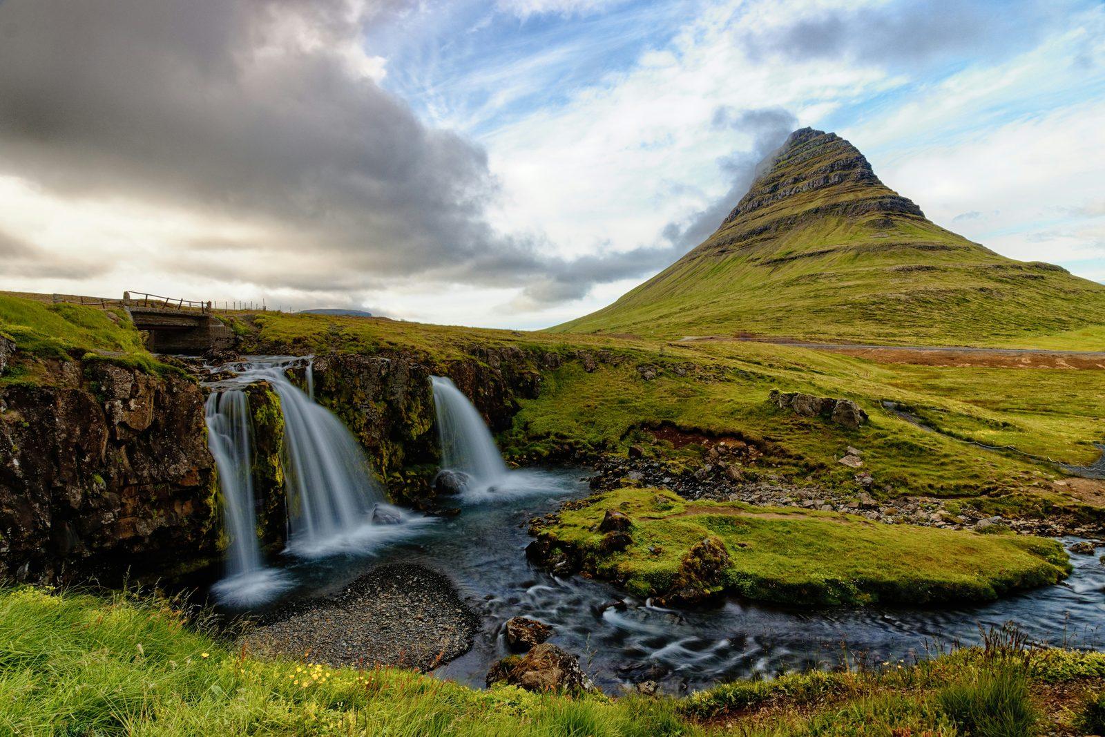
- Kirkjufell: Route 54 follows the north coast east to Grundarfjörður. Kirkjufell (463 m), often called the most photographed mountain in Iceland, rises just west of the town behind the waterfall Kirkjufellsfoss, whose car park is beside the road, about two minutes' drive from Grundarfjörður.
- Stykkishólmur: 39 km further, at the end of Route 58: the largest town on the peninsula, with colorful old timber houses and a lighthouse on the island of Súgandisey. The Baldur ferry leaves from its harbor; on a ferry the car travels at your own risk, and no waiver covers damage during sea transport (rental terms 25 and 36(j)).
- Back: Routes 58 and 54 to Vatnaleið (Route 56), across the peninsula to Route 54 on the south side, and on to Borgarnes and Route 1.
Short on time? Cross at Fróðárheiði
Route 54 crosses the peninsula over Fróðárheiði between Búðir and Ólafsvík: from Arnarstapi to Ólafsvík that way is 37 km, against 45 km round the tip on Route 574. You then miss Djúpalónssandur and the western tip.
A day trip or two days?
The whole loop is 484 km from Reykjavík: at least 5 h 20 min of driving at 90 km/h, the highest speed limit in Iceland, before a single stop. From Keflavík Airport it is 571 km, at least 6 h 20 min. Visit Iceland says a day trip from Reykjavík is possible but means five to six hours of driving, and recommends a night in one of the fishing villages.
| Plan | Route | Distance | Minimum driving at 90 km/h |
|---|---|---|---|
| One day from Reykjavík | The whole loop | 484 km | 5 h 20 min |
| One day from Keflavík Airport | The whole loop | 571 km | 6 h 20 min |
| Two days: day 1 | Reykjavík → Arnarstapi, Hellnar, Djúpalónssandur → Ólafsvík | 247 km (291 km from Keflavík Airport) | 2 h 40 min (3 h 10 min) |
| Two days: day 2 | Ólafsvík → Kirkjufell, Stykkishólmur → Reykjavík | 237 km (280 km to Keflavík Airport) | 2 h 35 min (3 h 5 min) |
- Our suggestion: two days, with a night in Ólafsvík, Grundarfjörður or Stykkishólmur. You see the stops in daylight and drive at a calm pace.
- Arriving on an overnight flight? Keep the first day short: Safetravel warns about tiredness and drowsiness at the wheel after a long flight.
- In winter: around the December solstice, Reykjavík has only about four hours of daylight, so the whole loop in one day means hours of driving in the dark. The Met Office publishes each day's sunrise and sunset for Ólafsvík and Stykkishólmur (in Icelandic).
Snæfellsjökull and the mountain roads
Snæfellsjökull, 1,446 m, is a stratovolcano with a small icecap on its summit; it last erupted about 1,800 years ago, and on clear days you can see it from Reykjavík. Enjoy it from the road and the trails:
- Never drive onto the glacier. Driving off the road is illegal in Iceland, and under our rental terms it costs €1,000 (40(f)). No waiver covers damage from driving on glaciers, frozen lakes or snow away from maintained roads (36(h)).
- Walk on it only with a certified glacier guide: Safetravel says never to go on a glacier without experience and the right equipment.
- Jökulhálsleið (road 570), the steep gravel pass from Arnarstapi over the shoulder of the glacier, which Visit Iceland calls F570, is open in summer only and gets no winter service. Vegagerðin marks the route over it, which continues on the F-road Eysteinsdalsleið (F575), as mountain roads open only part of the summer and not passable for ordinary cars: from Arnarstapi to Ólafsvík that way is 42 km, 22 km of it gravel.
Jökulháls in one of our cars
Only in a four-wheel-drive car your booking confirms as F-road approved, and only when the road is officially open (rental terms 16); Everyday and Family & Space cars never go on F-roads. Check umferdin.is before you turn off: a closed road is closed, driving one carries the €1,000 prohibited-road fee (40(g)), and no waiver covers the damage.
Safety and parking at the sights
- Djúpalónssandur and the other beaches: SafeTravel warns that Djúpalónssandur can always be dangerous because the waves are unpredictable. Stay well back from the water and keep children close. Never drive onto a beach: no waiver covers it (rental terms 36(h)).
- Kirkjufell: admire it, don't climb it. Visit Iceland calls the climb a steep, technical scramble that has seen several accidents, some of them fatal, fit only for experienced mountaineers with a professional local guide, and in winter often impossible. Walking paths round the base of the mountain take about two hours.
- Waterfalls and cliffs: spray makes the paths at Kirkjufellsfoss slippery, so wear shoes with a good grip. Stay on the marked paths and keep away from cliff edges in the national park.
- Stop only in parking areas, never on the road or its shoulder, however good the view.
- Parking fees: the car park at Kirkjufellsfoss charges a fee, Visit Iceland says, while the national park and its visitor center charge no admission. Elsewhere, paid parking may apply at some sites: follow the signs and pay on the spot. If an unpaid fee reaches us, we pass it on to you with our €10 processing fee (rental terms 22 and 40(i)).
Winter, wind and road conditions
Snæfellsnes is a year-round trip, but in winter the roads round the glacier get less snow clearing. Under Vegagerðin's winter service rules, these roads are cleared:
- Seven days a week: Route 54 from Route 1 to Vegamót, Vatnaleið (Route 56), and the north coast from Hellissandur through Ólafsvík and Grundarfjörður to Stykkishólmur.
- Six days a week: Route 54 west of Vegamót and over Fróðárheiði.
- Four days a week: Route 574 from Búðir to Hellnar.
- Two days a week: Route 574 from Hellnar round the tip to Hellissandur, past Djúpalónssandur.
- Not at all: Jökulhálsleið (road 570).
Wind is the biggest risk
Visit Iceland says the peninsula is known for sudden, powerful gusts. Before you set off, check the warnings on vedur.is and the road map on umferdin.is, which shows the wind and gusts at weather stations along the way, such as Fróðárheiði, Vatnaleið and Búlandshöfði between Ólafsvík and Grundarfjörður. Under an orange warning, drive only if you must; under a red one, don't travel. Park facing into the wind and hold the doors firmly (rental terms 18).
- Closed means closed: never drive past a closure sign or onto a road marked Lokað. From October to April the umferdin.is map is updated from 07:00 to 22:00; outside those hours, conditions can change before the map shows it.
- Tires and drive: every car has winter tires from 1 November to 14 April at no extra charge (rental terms 1). From November to March we strongly recommend AWD or a 4×4: it helps you get going in snow, but it does not stop a skid on ice.
- Flexible plans: keep the tank well filled and warm clothes in the car. If the weather turns, wait somewhere safe until it calms down, or change your plans.
- Car trouble: for a breakdown, a flat tire or a car stuck in snow, call us day or night on +354 779 9499; in an emergency, call 112. See Accident & breakdown.
Which car, and where to fill up
The main roads round the peninsula are paved: Vegagerðin's tables show every leg of the loop without gravel, and Visit Iceland says standard cars are fine on them all year.
- Roughly May to September: an Everyday car handles the loop; choose a bigger car for more people or luggage.
- November to March: we strongly recommend AWD or a 4×4, and Comfort is our default winter pick. In rough weather, a 4×4 is worth it: 4×4 Adventure or Highland 4×4.
- Jökulháls: only a car your booking confirms as F-road approved; on our website, Comfort, 4×4 Adventure and Highland 4×4 can be booked that way. More in F-roads & the Highlands.
Fuel: fill up in Borgarnes before you turn onto Route 54. On the peninsula, N1, for example, lists self-service stations open around the clock in Hellissandur and Grundarfjörður. Self-service pumps generally need a card with a PIN: see Fuel & paying at the pump.
Questions about driving the Snæfellsnes Peninsula
How long does it take to drive around the Snæfellsnes Peninsula?
By Vegagerðin's official distances, the classic loop is 484 km from Reykjavík and back and 571 km from Keflavík Airport, paved all the way. That is at least 5 h 20 min of driving from Reykjavík at 90 km/h without stops, or 6 h 20 min from the airport. Visit Iceland expects five to six hours of driving on a day trip and suggests two to three days for a relaxed pace.
Can I do Snæfellsnes as a day trip from Reykjavík or Keflavík Airport?
You can, but it makes a long day: at least 5 h 20 min of driving from Reykjavík and 6 h 20 min from Keflavík Airport before any stops, and around the December solstice Reykjavík gets only about four hours of daylight. We suggest two days, with a night in Ólafsvík, Grundarfjörður or Stykkishólmur. If you land after an overnight flight, keep the first day short.
How far is Snæfellsnes from Keflavík Airport?
Borgarnes, where the road onto the peninsula starts, is 117 km from the airport terminal. Stykkishólmur is 215 km, Grundarfjörður and Kirkjufell 220 km and Arnarstapi 236 km, all on paved roads through the Hvalfjörður tunnel, which has no toll. From Reykjavík: Borgarnes 74 km, Stykkishólmur 172 km, Grundarfjörður 177 km and Arnarstapi 192 km.
Do I need a 4×4 for the Snæfellsnes Peninsula?
Not for the loop: every leg is paved, and Visit Iceland says standard cars are fine on the main roads all year. Every car has winter tires from 1 November to 14 April, and from November to March we strongly recommend AWD or a 4×4. The gravel mountain road over Jökulháls (road 570) is different: only a four-wheel-drive car your booking confirms as F-road approved, and only when it is officially open.
Can I drive up Snæfellsjökull glacier?
No car may drive onto the glacier: off-road driving is illegal in Iceland, and no waiver covers damage from driving on glaciers (rental terms 36(h)). Walk on the glacier only with a certified glacier guide. The mountain road over Jökulháls on the glacier's shoulder is open in summer only, and under our rental terms only in a four-wheel-drive car your booking confirms as F-road approved.
Is there a toll on the way to Snæfellsnes?
No. The Hvalfjörður tunnel on Route 1 between Reykjavík and Borgarnes has no toll; Iceland's only road tolls are the Vaðlaheiði tunnel near Akureyri and the Hornafjörður bridge near Höfn. Some car parks charge a fee, such as the one at Kirkjufellsfoss.
Do I have to pay to park at Kirkjufell?
Visit Iceland says the car park at Kirkjufellsfoss, the classic viewpoint for the mountain, charges a fee; looking at the mountain itself is free. Snæfellsjökull National Park and its visitor center at Malarrif charge no admission. Elsewhere, follow the signs at each car park.
Can I drive the Snæfellsnes Peninsula in winter?
Yes, Visit Iceland calls it a year-round trip, but plan two days. Route 54 to Vegamót, Vatnaleið and the north coast are cleared seven days a week, while Route 574 round the glacier's tip is cleared only two days a week, so check umferdin.is and the warnings on vedur.is before you set off. Wind is the main risk: the peninsula is known for sudden, powerful gusts.
Official sources
The facts on this page come from these sources (checked 10 November 2026):
- Distances between places (Vegalengdir) — Vegagerðin, in Icelandic
- Winter service: snow-clearing rules — umferdin.is (Icelandic Road and Coastal Administration)
- Weather warnings — Icelandic Met Office (vedur.is)
- Winter driving — Safetravel
- Snæfellsnes Peninsula — Visit Iceland
- Kirkjufell Mountain — Visit Iceland
- Tolls in Iceland: questions and answers — Spölur
- Rental terms — Ring Road Cars