
Reykjanes Peninsula eruptions: your trip, flights and rental car
Last updated: 11 November 2026
Prepared by Ring Road Cars at Keflavík Airport and checked against the official sources listed at the end of this page.
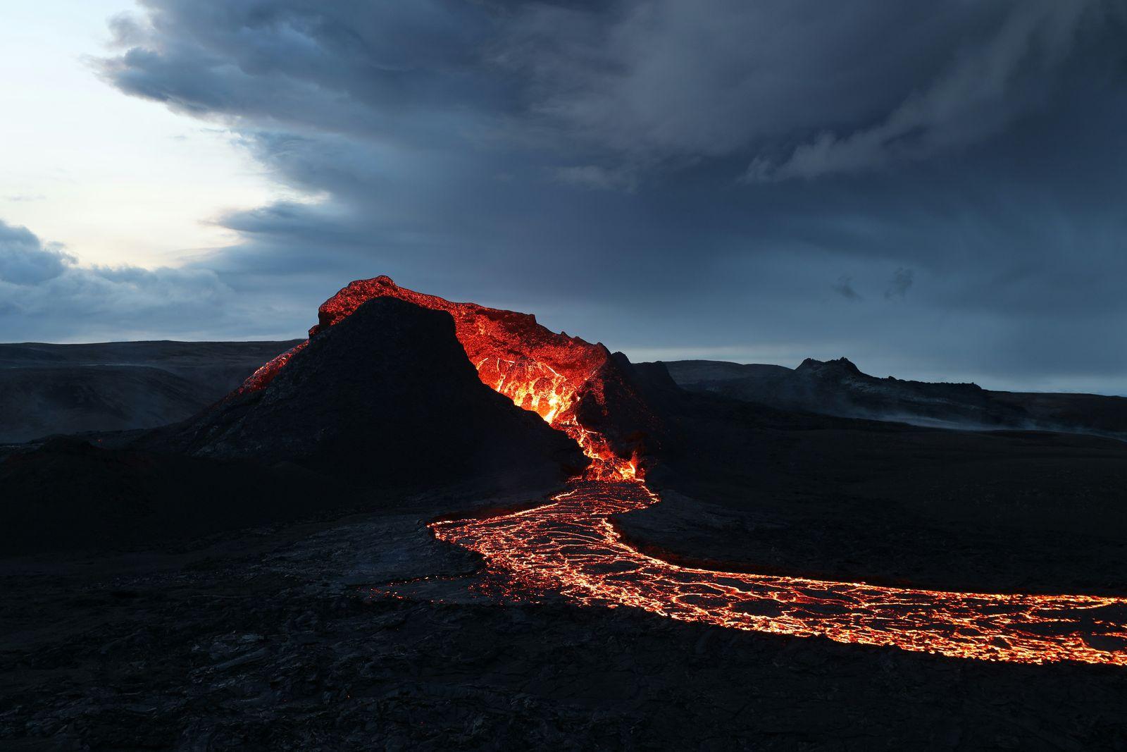
Short answer
As of 11 November 2026, there is no eruption on the Reykjanes Peninsula. The last one, the ninth on the Sundhnúkur crater row north of Grindavík, lasted from 16 July to 5 August 2025. The Icelandic Met Office says magma is still accumulating and that a new magma intrusion, which could lead to an eruption, remains the most likely scenario; its timing can't be predicted, and the warning may be short. According to the Icelandic government, the eruptions there since 2021 have not affected air travel. Their effects have been local: lava has crossed and closed roads near Grindavík and the Blue Lagoon, while the road from the airport to Reykjavík was reported open during past eruptions. On the day you drive, check the Met Office, umferdin.is and Safetravel, and never pass a closure or walk on new lava.
The situation as of 11 November 2026
Since March 2021, the Reykjanes Peninsula has had twelve eruptions: three at Fagradalsfjall, in 2021, 2022 and 2023, then nine on the Sundhnúkur crater row north of Grindavík, between December 2023 and August 2025. The latest began on 16 July 2025 and ended on 5 August 2025. In its update of 10 November 2026, the Icelandic Met Office reports:
- Magma is still accumulating beneath Svartsengi, shown by steady ground uplift; seismic activity is very low.
- A magma intrusion, which could lead to an eruption, remains the most likely scenario. The time of the next event can't be predicted, and the warning could still be short: before earlier eruptions on the crater row it ranged from about 20 minutes to a few hours, and clear signs can't be expected in the days before an eruption.
- The Reykjanes–Svartsengi volcanic system stays at alert level 2 (orange). On the hazard map issued on 30 September 2026, Grindavík is in the considerable (orange) hazard category and Svartsengi, where the Blue Lagoon is, in the moderate (yellow) one.
- Grindavík is open and at Civil Protection's uncertainty phase; no evacuation is needed at present (town update of 14 September 2026). Grindavík and the Blue Lagoon were evacuated as a precaution when the July 2025 eruption began, and both have since reopened.
No one can say when the next eruption will start
The Met Office says the timing of the next event can't be predicted, and that a long pause is not, in itself, a sign that the activity has ended. So this page doesn't guess: it shows you where to check on the day, and what to do if an eruption starts while you're here.
Where to check live, on the day you drive near Grindavík or the Blue Lagoon:
| What you need | Where to look |
|---|---|
| Eruption status and warnings | The Icelandic Met Office's latest update and hazard map |
| Evacuations and Grindavík | Civil Protection and Grindavík's status page (in Icelandic) |
| Road closures | umferdin.is, the Road Administration's live map |
| Travel alerts | Safetravel's page on the eruption area |
| Volcanic gas | The Met Office's gas forecast, issued during an eruption, and air quality on loftgaedi.is |
| Flights | Keflavík Airport and your airline |
| Trails, parking and the Blue Lagoon | Visit Reykjanes and the Blue Lagoon's seismic activity page |
Flights to and from Keflavík Airport
According to the Icelandic government, the eruptions on the Reykjanes Peninsula have not affected air travel to and from Iceland. When the latest began on 16 July 2025, Keflavík Airport reported flights operating normally and on schedule, and the Met Office said the eruption produced no ash and so did not affect air traffic.
Past eruptions are no promise for the next one: if an eruption starts before your flight, check its status with Keflavík Airport or your airline. If your arrival is delayed, tell us as soon as you can. The car must be collected within two hours of the booked pickup time, or the booking may be treated as a no-show; we try to hold it for a delay reported in advance (rental terms, clause 10).
Roads near the eruption area
The eruptions have closed or cut the roads around Grindavík and the Blue Lagoon. Route 43 (Grindavíkurvegur), the road to both, leaves Reykjanesbraut (Route 41) about 12 km from the airport terminal. Reykjanesbraut itself, the road between the airport and Reykjavík, was reported open during past eruptions.
| Road | Where it goes | What has happened |
|---|---|---|
| 41 Reykjanesbraut | Keflavík Airport to Reykjavík | Reported open during past eruptions, for example in December 2023 and August 2024. Visitors were asked not to stop on it to watch an eruption. |
| 43 Grindavíkurvegur | Route 41 to the Blue Lagoon and Grindavík | Lava crossed it several times in 2024, including in February, May and November, and sections were rebuilt over the new lava. During eruptions it has been closed at Seltjörn, at times open only to guests with a booking in Svartsengi. |
| 426 Bláalónsvegur | The road to the Blue Lagoon | Much of it went under lava on 8 February 2024; it was rebuilt inside the barriers that protect Svartsengi. |
| 425 Nesvegur | The coast road west of Grindavík | Lava flowed over it in May 2024; in June it was closed at Staður, west of Grindavík. |
| 427 Suðurstrandarvegur | East from Grindavík, past the Fagradalsfjall car parks | Closed at Krýsuvíkurvegur in June 2024; in August 2024 the closure moved to the P1 car park at Fagradalsfjall, and the trails reopened. |
A closed road is closed
Navigation apps don't always show closures: Safetravel warns that maps may not reflect closed or impassable roads, and the Blue Lagoon says some apps show outdated routes, so follow the road signs. Never drive past a closure or off the road: off-road driving is illegal in Iceland. Under our rental terms, it carries the off-road driving fee (€1,000) or the prohibited-road fee (€1,000), and no waiver covers the damage; leaving the road because the police or road works send you off it is not a breach (clause 16).
On the new lava, stop only in car parks, never on the road or its shoulder. Vegagerðin, the Road Administration, has warned that walking on new lava is very dangerous and illegal.
Driving to the Blue Lagoon or Grindavík
From the airport terminal, the Blue Lagoon is 23 km away on Routes 41, 43 and 426, and Grindavík 26 km on Routes 41 and 43, paved all the way (Vegagerðin). Both have reopened since the July 2025 eruption, but both lie in the area the Met Office's hazard map covers, and an evacuation can come at short notice.
- Before you go: check Route 43 on umferdin.is, and if you have a Blue Lagoon booking, its seismic activity page. During past eruptions, only guests with a booking in Svartsengi were let through the closure post on Route 43 at Seltjörn.
- Evacuation sirens stand in Grindavík and in Svartsengi, by the Blue Lagoon. A loud, continuous siren means leave the area at once, following Civil Protection's instructions. The sirens are tested on the last Wednesday of each month; a test is a short sound and means no danger.
- In Grindavík: follow the signs and the responders' instructions, and if the town is evacuated, drive out at once by the route they give, keeping the road clear. Affected areas are fenced off, and walking outside areas marked safe is dangerous because of unmapped crevasses.
- At the Blue Lagoon: in an evacuation, follow the staff's directions, and never walk on the protective barriers around Svartsengi.
For the sights and a loop of the whole peninsula, see Reykjanes Peninsula by car.
Seeing an eruption or new lava: viewpoints, parking and trails
When an eruption starts, the area around it is closed, and the police can stop all traffic to it without notice. It opens again only when the authorities decide, with marked car parks and trails: in August 2024, for example, the closure on road 427 moved to the P1 car park at Fagradalsfjall, and the trails there reopened.
Until then, watch from a distance. During the August 2024 eruption, Visit Reykjanes pointed visitors to viewpoints on the north side of the peninsula, such as Reykjanesbær and Vogar, and to the live webcams of RÚV and mbl.is. An eruption can be visible from Reykjanesbraut, but don't stop on the highway or its shoulder.
With no eruption under way, you can walk to the lava fields of recent years:
- Path B, from the P1 car park by Fagradalsfjall (road 427): 4.7 km one way to the first viewpoint over the 2023–2025 lava field and craters, 6.1 km to the second, about 1.5–2 hours each way. Parking at P1 and P2 costs a fee, paid through Parka; the signs at the car park explain how.
- A shorter stop: the lava-field viewpoint by Route 43, near the Blue Lagoon, which Visit Reykjanes suggests when the weather is poor or you have young children.
- In winter, the trails are not serviced: expect snow and ice, check the weather, and postpone the hike if visibility is poor.
Never walk on new lava
The Icelandic Met Office calls it life-threatening: the crust can break without warning over glowing lava, and lava edges can collapse or surge forward suddenly, even after an eruption has ended. Safetravel says hiking on the lava is strictly forbidden. Stay on marked trails, and drive only on open roads to marked car parks.
Volcanic gas
The main gas from the eruptions is sulfur dioxide (SO₂). It comes from the eruption plume and from new lava, and it can cause drowsiness, headaches, eye and throat irritation and breathing symptoms; children and people with heart or lung conditions are more sensitive. Near an eruption site, gas can exceed danger levels at any time, and in light wind it collects in valleys. The wind can carry it far: on the first day of the July 2025 eruption, the Met Office reported high levels measured in Reykjanesbær and advised residents to stay indoors.
- Before you go: during an eruption, the Met Office issues a gas dispersion forecast, and loftgaedi.is shows measured air quality.
- At a viewpoint or on a trail: watch with the wind at your back, and in light wind move to higher ground such as hills and ridges. If the wind blows from the north, gas may drift over the Fagradalsfjall trails: skip the hike, especially with children.
- If you feel symptoms, leave the polluted area. In the car, keep the windows closed. Heavy pollution affects a driver's concentration and very high SO₂ levels can cause unconsciousness, so never drive into a gas plume; if you feel unwell at the wheel, stop somewhere safe and call 112.
- In town, when pollution is high: stay indoors, close the windows and turn off ventilation. If symptoms don't pass, call the health advice line 1700; in an emergency, call 112.
If an eruption starts during your rental
- Follow the authorities. If a siren sounds or an evacuation is ordered, leave at once by the signposted route and keep the road clear for emergency vehicles. In an emergency, call 112.
- Don't drive toward the eruption. Roads near it can close at short notice and stay closed until the authorities reopen the area.
- If a closure or warning stops you from returning the car on time, tell us before the return time. Using the car more than an hour past the agreed return time without our consent is unauthorized use, with no waiver cover, unless you've told us that a road closure, weather warning or other circumstance beyond your control prevents the return. The extra time is still charged (clause 12).
- Call us day or night on +354 779 9499 if something happens to the car: every rental includes 24/7 breakdown and emergency assistance (clause 50).
Ash: the July 2025 eruption produced no ash, according to the Met Office, but tephra fallout is one of the hazards on its map, and windblown sand and ash can damage a car in strong wind. Sand and Ash Protection (SAP, €15 a day) and MAX (€40 a day) cover damage from sandstorms, erosion and ash at no excess, except in an area under an orange or red wind warning from the Icelandic Met Office (clause 38). Without SAP or MAX, no cover option includes ash damage: it is charged in full (clause 36), and after the return inspection we may hold up to €10,000 on your card for it (clause 7). More in Rental car cover.
Your booking: changes, cancellations and what we can't promise
Our rental terms treat an eruption like severe weather or a road closure: we are not liable for losses caused by circumstances beyond our reasonable control, such as eruptions, severe weather or road closures, nor for indirect losses such as missed flights or accommodation (clause 32). The usual booking rules apply (clause 8):
- Canceling: at least 48 hours before the scheduled pickup, you get a full refund; a later cancellation or a no-show is not refunded. Booked through a travel agent or booking website? Cancel through them.
- Changing dates: subject to availability and, within 48 hours of pickup, to our consent. Each change costs €10 and reprices the booking.
- A canceled or badly delayed flight: tell us as early as you can. That is exactly the situation where we try to move your dates, but we can't promise it.
- Returning early: days you don't use are not refunded, for example if closed roads cut a trip short (clause 12).
- Travel insurance: the Icelandic government advises travelers to make sure their travel insurance covers disruption caused by natural events such as eruptions. We send you the written confirmation an insurer needs.
All the rules: Cancellation policy and the rental terms.
Questions about volcanic eruptions and your trip
Is it safe to travel to Iceland during a volcanic eruption?
The eruptions on the Reykjanes Peninsula have been local. During the July 2025 eruption, the Icelandic government said the activity was highly localized and had no impact on air traffic or on attractions across the rest of Iceland. Near an eruption, follow the authorities: closed areas stay closed, walking on new lava is life-threatening, and gas can reach dangerous levels. As of 11 November 2026 there is no eruption, but the Icelandic Met Office says a magma intrusion that could lead to one remains the most likely scenario and the warning may be short, so check vedur.is, safetravel.is and umferdin.is on the day.
Will a volcanic eruption on the Reykjanes Peninsula affect my flight to Keflavík?
According to the Icelandic government, the eruptions there since 2021 have not affected air travel to and from Iceland. When the latest began on 16 July 2025, Keflavík Airport reported flights operating normally and on schedule, and the Icelandic Met Office said that eruption produced no ash. Past eruptions are no promise for the next one, so if an eruption starts, check your flight with the airport or your airline, and tell us if your arrival is delayed.
Can I drive to the Blue Lagoon or Grindavík?
Yes, when the roads are open. Both have reopened since the July 2025 eruption. From the airport terminal, the Blue Lagoon is 23 km and Grindavík 26 km away, both by Route 43, which lava crossed several times in 2024 and which has been closed, or open only to guests with a booking, during eruptions. Check umferdin.is and Civil Protection before you go, and leave at once by the signposted route if the evacuation sirens sound.
Can I see an eruption, and where can I park?
Only where and when the authorities allow. When an eruption starts, the area around it is closed; it reopens later, if at all, with marked car parks and trails. During past eruptions, visitors were pointed to viewpoints on the north side of the peninsula, such as Reykjanesbær and Vogar, and to live webcams. With no eruption under way, Path B from the P1 car park by Fagradalsfjall leads to viewpoints over the 2023–2025 lava; P1 and P2 charge a parking fee, paid through Parka. Never stop on the road, never drive off it, and never walk on new lava.
What should I do about volcanic gas?
During an eruption, check the Icelandic Met Office's gas forecast and the air quality on loftgaedi.is. Near the site, watch with the wind at your back and move to higher ground in light wind. If you feel symptoms, such as irritated eyes or throat, a headache or difficulty breathing, leave the polluted area; in the car, keep the windows closed and never drive into a gas plume, and if you feel unwell at the wheel, stop somewhere safe and call 112. In towns, stay indoors with the windows closed when pollution is high. For health advice call 1700, and in an emergency 112.
What happens to my rental car and booking if an eruption starts?
Your rental continues under the usual terms. Follow the authorities, never pass a closed road, and if a closure or warning stops you from returning on time, tell us before the return time: the delay then isn't unauthorized use, though the extra time is charged. We are not liable for losses caused by eruptions or road closures, such as a missed flight (rental terms, clause 32). A booking canceled at least 48 hours before pickup is refunded in full; later, it isn't, and a non-refundable rate bought elsewhere is never refunded (rental terms, clause 8). Call us day or night on +354 779 9499.
Does your cover include damage from volcanic ash?
Only with Sand and Ash Protection (SAP, €15 a day) or MAX (€40 a day), which cover damage from sandstorms, erosion and ash at no excess, except in an area under an orange or red wind warning from the Icelandic Met Office. Without them, ash damage is charged in full. No cover option pays for damage from driving off-road or on a closed road.
Official sources
The facts on this page come from these sources (checked 11 November 2026):
- Ground uplift continues at Svartsengi (updated 10 November 2026) — Icelandic Met Office
- Hazard map for the Reykjanes Peninsula (issued 30 September 2026) — Icelandic Met Office
- The ninth eruption on the Sundhnúkur crater row has ended (2025) — Icelandic Met Office
- Eruption updates, November–December 2024 — Icelandic Met Office
- Gas dispersion forecast — Icelandic Met Office
- Gas pollution at the eruption site: advice — Icelandic Met Office
- Reykjanes Peninsula — Civil Protection (Almannavarnir)
- Lava over Grindavíkurvegur and Nesvegur (29 May 2024) — Civil Protection
- Natural hazards and the town's Civil Protection status (in Icelandic) — Grindavík
- Road closures and conditions — umferdin.is (Icelandic Road and Coastal Administration)
- Road to Blue Lagoon open (28 February 2024) — Vegagerðin
- IRCA's work in and around Grindavík (7 March 2024) — Vegagerðin
- Distance from Keflavík Airport to the Blue Lagoon (in Icelandic) — Vegagerðin
- Distance from Keflavík Airport to Grindavík (in Icelandic) — Vegagerðin
- Eruption and earthquakes in the Reykjanes Peninsula — Safetravel
- How to drive in Iceland — Safetravel
- A volcanic eruption on the Reykjanes peninsula (16 July 2025) — Keflavík Airport
- Arrivals and departures — Keflavík Airport
- Volcanic activity in Reykjanes (updated 30 July 2025) — Government of Iceland
- No ongoing volcanic eruption in Iceland — Visit Iceland
- Eruption news — Visit Reykjanes
- Hiking to the eruption site in Sundhnúksgígar — Visit Reykjanes
- Hiking and parking at the eruption sites — Visit Reykjanes
- Safety information for the eruption site — Visit Reykjanes
- The eruption on the Reykjanes peninsula (19 December 2023) — Visit Reykjanes
- Lava closes road 43, Grindavíkurvegur (8 June 2024) — Visit Reykjanes
- Checkpoints and openings during the eruption (25 August 2024) — Visit Reykjanes
- Evacuation sirens in Grindavík and Svartsengi (December 2025) — Visit Reykjanes
- Winter conditions on the hiking trails — Visit Reykjanes
- Seismic activity information — Blue Lagoon
- Volcanic eruption: recommendations for health effects — Ísland.is (Directorate of Health)
- Volcanic eruption in Reykjanes: health effects — Directorate of Health
- Health hazards of air pollution from eruptions, 4th edition, 2022 (in Icelandic, PDF) — Directorate of Health and partners
- Air quality in Iceland — loftgaedi.is (Environment and Energy Agency)
- Off-road driving is prohibited — Ísland.is
- Rental terms — Ring Road Cars
- Cancellation policy — Ring Road Cars