
North Iceland by car: Akureyri, Mývatn and the Diamond Circle
Last updated: 11 November 2026
Prepared by Ring Road Cars at Keflavík Airport and checked against the official sources listed at the end of this page.
Short answer
From Reykjavík, Route 1 runs north through the Hvalfjörður tunnel (no toll) and over the mountain passes Holtavörðuheiði and Öxnadalsheiði to Akureyri: 388 km, at least 4 h 15 min at 90 km/h; from Keflavík Airport it is 431 km, a long first day. The Diamond Circle (Goðafoss, Mývatn, Dettifoss, Ásbyrgi and Húsavík) is 311 km of paved road from Akureyri and back, at least 3 h 15 min of driving: plan two days. In winter, Route 1 to Mývatn and road 85 to Húsavík are cleared every day, but road 862 to Dettifoss only on some days, from January only on request, and road 864 not at all. Check umferdin.is and vedur.is before every leg.
Getting there from Reykjavík or Keflavík Airport
- From Keflavík Airport: Reykjanesbraut (Route 41) toward Reykjavík, then Route 1 north.
- Over the passes: through the Hvalfjörður tunnel (no toll), past Borgarnes and over Holtavörðuheiði, Vatnsskarð and Öxnadalsheiði down to Akureyri, mountain passes where the weather can change fast.
- On to Mývatn: east of Akureyri, through the Vaðlaheiði tunnel (toll) and past Goðafoss.
| Destination | From Keflavík Airport | From Reykjavík |
|---|---|---|
| Akureyri | 431 km (4 h 45 min) | 388 km (4 h 15 min) |
| Mývatn (Reykjahlíð) | 514 km (5 h 40 min) | 471 km (5 h 10 min) |
| Húsavík | 506 km (5 h 35 min) | 463 km (5 h 5 min) |
These are the official distances of Vegagerðin, the Icelandic Road and Coastal Administration (distance tables, in Icelandic), all on paved roads; Visit Iceland puts North Iceland about five hours' drive from Reykjavík. Airport distances start at the terminal; our office at Bogatröð 1 in Reykjanesbær is about 10 minutes away by our airport shuttle.
A long first day, and no Highland shortcuts
Akureyri is at least 4 h 45 min from the airport before any stop, and Safetravel warns of drowsiness after an overnight flight: consider a night on the way. Ignore Highland shortcuts from navigation apps: our rental terms never allow F26 (Sprengisandur), and allow Kjölur (road 35 north of Gullfoss) only in a four-wheel-drive car your booking confirms as F-road approved, when officially open (clause 16).
The Diamond Circle, leg by leg
Visit North Iceland describes the Diamond Circle as a circuit of about 250 km with five key stops: Goðafoss, Lake Mývatn, Dettifoss, Ásbyrgi canyon and Húsavík, and Visit Iceland gives the same length. From Akureyri, North Iceland's main town, by Vegagerðin's distances:
| Leg | Main roads | Distance | Minimum at 90 km/h |
|---|---|---|---|
| Akureyri → Goðafoss | 1 (Vaðlaheiði tunnel) | 34 km | 20 min |
| Goðafoss → Mývatn (Reykjahlíð) | 1 | 49 km | 30 min |
| Mývatn → Dettifoss (west bank) | 1, 862 | 50 km | 30 min |
| Dettifoss → Ásbyrgi | 862, 85 | 38 km | 25 min |
| Ásbyrgi → Húsavík | 85 | 65 km | 40 min |
| Húsavík → Akureyri | 85, 1 (Vaðlaheiði tunnel) | 75 km | 50 min |
| Total | Akureyri and back | 311 km | 3 h 15 min |
Every leg is paved; without the Akureyri legs, Goðafoss round to Goðafoss is 249 km. Allow at least 3 h 15 min at the wheel before any stop: Visit Iceland suggests one to three days and recommends at least two, as do we, with a night near Mývatn or in Húsavík.
The Vaðlaheiði tunnel toll
Both Akureyri legs go through the Vaðlaheiði tunnel (Vaðlaheiðargöng). There are no booths: pay at veggjald.is within 24 hours before or after each trip through, with the car's registration number (price on our Tolls & parking page). The toll-free road over Víkurskarð is 16 km longer. An unpaid toll is billed to us and passed on with our €10 processing fee (rental terms 22 and 40(i)).
The stops on the way
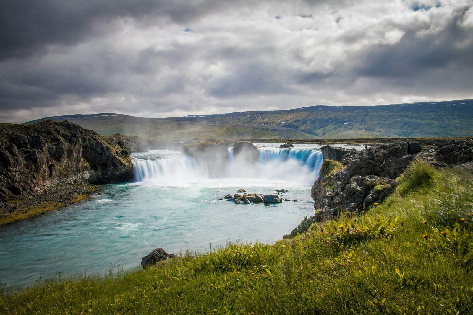
- Goðafoss: by Route 1, 34 km east of Akureyri. The river Skjálfandafljót falls 12 m over a width of 30 m, with parking on both sides and paved paths to viewing platforms.
- Mývatn: Iceland's fourth-largest lake, formed in an eruption more than 2,000 years ago. From Reykjahlíð on Route 1, road 848 takes the far shore to the lava formations of Dimmuborgir (6 km); nearby are the pseudocraters at Skútustaðir and, just east of the lake, the steaming geothermal area Hverir (Námaskarð): stay on the marked paths.
- Dettifoss: Europe's most powerful waterfall, 45 m high and 100 m wide, in the canyon Jökulsárgljúfur; paved road 862 reaches the west bank, 24 km from Route 1.
- Ásbyrgi: a horseshoe-shaped canyon with cliffs up to 100 m high in Vatnajökull National Park; in folklore, the hoofprint of Sleipnir, Odin's eight-legged horse. Gljúfrastofa, the park's visitor center for the north, is here.
- Húsavík: a harbor town known for whale watching, with its own whale museum.
Which roads reach Dettifoss
- West bank, road 862: paved from Route 1 past Dettifoss to road 85 near Ásbyrgi, the road in the table. All our cars may drive it when it is open.
- East bank, road 864: gravel; from Mývatn it is 69 km, 32 km of it gravel. Visit North Iceland says it is closed in winter, because of snow or mud, until early summer (around the end of May).
Road 864 in one of our cars
Our rental terms (clause 16) allow road 864 only in a four-wheel-drive vehicle (4x4, 4WD or AWD) your booking confirms as F-road approved, and only when officially open: on our website, Comfort, 4×4 Adventure or Highland 4×4, never Everyday or Family & Space. Driving a closed or prohibited road carries the €1,000 prohibited-road fee (40(g)), and no waiver covers the damage.
Mývatn and Dettifoss in winter
Vegagerðin's winter service rules treat the roads of the north very differently:
- Seven days a week: Route 1 over Holtavörðuheiði and Öxnadalsheiði to Akureyri and on past Goðafoss and Mývatn, road 848 round the lake, and roads 845 and 85 to Húsavík.
- Road 862 from Route 1 to Dettifoss: two days a week in autumn (until 1 November) and spring (from 20 March) while snow is light; in between, once a week until 5 January, then only on request.
- No winter service: road 862 north of Dettifoss, and road 864.
So from November to March, don't count on Dettifoss. On roads cleared every day, Akureyri – Goðafoss – Mývatn – Húsavík – Akureyri is 234 km via Route 1 and roads 845 and 85 (at least 2 h 30 min); road 87, the shorter way from Mývatn to Húsavík, is cleared only twice a week over Hólasandur. Try Dettifoss only if umferdin.is shows road 862 open.
Passes, wind and closures
Storms can close Holtavörðuheiði, Öxnadalsheiði and the north-east highlands beyond Mývatn for hours or days. Check the warnings on vedur.is: under an orange warning, drive only if you must; under a red one, don't travel. Never drive past a closure sign or onto a road marked Lokað.
- Daylight: on 10 November the sun rose in Akureyri at 09:37 and set at 16:15; around the December solstice Reykjavík gets about four hours of daylight, and Akureyri less. The Met Office publishes each day's sunrise and sunset (in Icelandic).
- Northern lights: September to April, on dark, clear nights: check the aurora and cloud forecast and park only in a proper parking area, never on the road (Northern lights by car).
- Tires and drive: winter tires on every car from 1 November to 14 April at no extra charge (rental terms 1); from November to March we strongly recommend AWD or a 4×4, though, as Safetravel notes, it does not stop a skid on ice.
North Iceland on a Ring Road trip
Route 1, about 1,310 km around Iceland, itself passes Akureyri, Goðafoss and Mývatn; we suggest 6 to 11 days for the loop, and at least 10 in winter. East of Mývatn, Dettifoss is a 24 km detour each way on road 862, and Ásbyrgi and Húsavík complete the circle: give the north at least one extra day. See Ring Road car rental and our day-by-day Ring Road itinerary.
Which car, and returning it elsewhere
- Roughly May to September: every leg above is paved, so an Everyday car will do; choose a bigger one for more people or luggage.
- November to March: we strongly recommend AWD or a 4×4; Comfort is our default winter pick, and 4×4 Adventure and Highland 4×4 have more ground clearance.
Ending your trip in Akureyri? We rent from our office near Keflavík Airport, where the car goes back. A return in Akureyri or another town is possible only on request, agreed in advance; we confirm the one-way fee in writing when we agree it (rental terms 11 and 40(o); see Locations).
Car trouble: call us day or night on +354 779 9499; in an emergency, call 112 (Accident & breakdown).
Questions about driving in North Iceland
How do I drive to North Iceland from Reykjavík?
Take Route 1 north through the Hvalfjörður tunnel (no toll), past Borgarnes and over the mountain passes Holtavörðuheiði and Öxnadalsheiði to Akureyri: 388 km of paved road, at least 4 h 15 min at 90 km/h. Visit Iceland puts North Iceland about five hours' drive from Reykjavík; from Keflavík Airport, Akureyri is 431 km.
What is the Diamond Circle and how long does it take?
A circuit of about 250 km with five key stops: Goðafoss, Lake Mývatn, Dettifoss, Ásbyrgi canyon and Húsavík. From Akureyri and back it is 311 km of paved road by Vegagerðin's official distances, at least 3 h 15 min of driving; Visit Iceland suggests one to three days, and we suggest two.
Can I drive to Mývatn and Dettifoss in winter?
Mývatn, usually yes: Route 1 from Akureyri is cleared seven days a week, though storms can close it for hours or days. Dettifoss is uncertain: road 862 is cleared only on some days in autumn and spring and, from 5 January, only on request; road 864 gets no winter service. Check umferdin.is before you set off.
Is the road to Dettifoss paved?
On the west bank, yes: road 862 is paved, 24 km each way from Route 1, and all our cars may drive it when it is open. Road 864 on the east bank is gravel and, under our rental terms, only for a four-wheel-drive car your booking confirms as F-road approved, when officially open.
Is there a toll on the way to Mývatn and Húsavík?
Yes: the Vaðlaheiði tunnel on Route 1, just east of Akureyri. Pay at veggjald.is within 24 hours before or after each trip, with the car's registration number; the toll-free road over Víkurskarð is 16 km longer. An unpaid toll that reaches us is passed on with our €10 processing fee.
Can I pick up the car at Keflavík Airport and return it in Akureyri?
Only on request, agreed in advance. We rent from our office near Keflavík Airport, where the car normally goes back; for a return in Akureyri or another town, we confirm the one-way fee in writing when we agree it (rental terms 11 and 40(o)).
Do I need a 4×4 for North Iceland?
Not in summer: Route 1 and the Diamond Circle are paved. Every car has winter tires from 1 November to 14 April, and from November to March we strongly recommend AWD or a 4×4. Road 864 to Dettifoss's east bank needs a four-wheel-drive car your booking confirms as F-road approved, when officially open.
Official sources
The facts on this page come from these sources (checked 10 November 2026):
- Distances between places (Vegalengdir) — Vegagerðin, in Icelandic
- Winter service: snow-clearing rules — umferdin.is (Icelandic Road and Coastal Administration)
- Weather warnings — Icelandic Met Office (vedur.is)
- Winter driving — Safetravel
- The Diamond Circle — Visit Iceland
- Dettifoss: roads 862 and 864 — Visit North Iceland
- Vaðlaheiði tunnel: prices and payment — veggjald.is, in Icelandic
- Rental terms — Ring Road Cars